Photographing The North West Tasmania Wilderness
North West Tasmania – Where The Rugged West Coast Borders The Tarkine Wilderness
I couldn’t have said it better myself
Nestled in the North-West corner of Tasmania is the greatest temperate rainforest, and the second largest in the world, the Tarkine is an intriguing experience.
Unlike many places in the world the Tarkine remains as a hidden treasure and a forgotten wilderness. Not only is it home to the largest temperate rainforest in Australia (and second in the world), it is alive with unique creatures and habitats not found anywhere else.
The Tarkine speaks for itself, and when you visit you will know why it is becoming known as a high quality ecotourism destination.
The 447,000 hectare Tarkine Wilderness Area is Australia’s largest tract of unprotected temperate rainforest.
~ Courtesy of Discover The Tarkine
What Makes North West Tasmania so special?
I know it’s probably cliche, but I do honestly believe that North West Tasmania is a photographer’s paradise. It really does have it all – lush rainforests, incredible coastlines, rugged mountain ranges, and serene lakes.
I had heard Tasmania being described as the love child of Australia and New Zealand and it’s hard to argue with that. Because of its size, it is easy to travel around. It doesn’t long before you are out of the ‘city’ and in untouched, pristine nature at its best.
Having visited the East Coast of Tasmania, I was really keen to photograph the North West Tasmania Wilderness. As I’m a solo traveller, I chose to do a dedicated photography tour to the area. It was just so different from the beaches and coastline of the area where I live.
It was such an experience being able to photograph some of the world’s last unspoiled areas in this remote area. From ancient rainforests of the Tarkine to remote and wild coastline. It is an absolute dream area and not (yet?) overrun with other photographers.
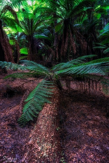
It is really difficult to adequately describe this incredible area – think rainforests, but then add the most rugged and wild coastline’s I have ever seen – it has gorgeous mossy, fern-filled walks, giant trees, waterfalls, wild beaches – and you barely see another soul!
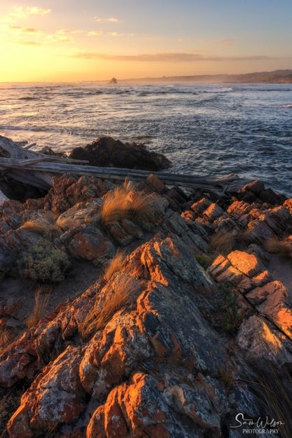
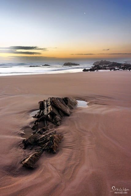
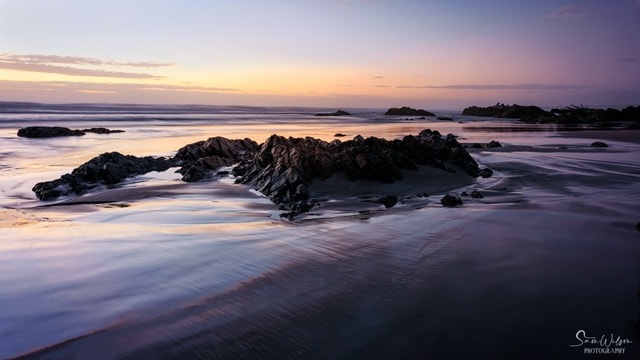
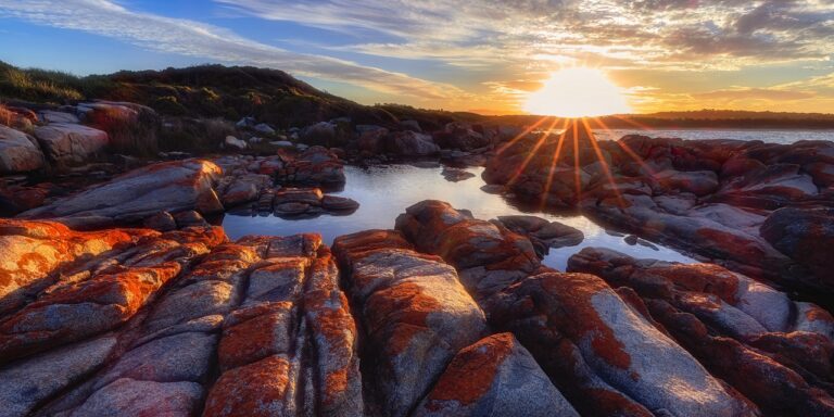
At the risk of sounding cliche, the coastline is incredibly spectacular. While I live on the coast and regularly shoot seascapes, these were truly something else – incredibly beautiful in their rawness.
Let’s get to it and show off the beautiful area I was able to photograph in North West Tasmania. We based ourselves just outside of Stanley and travelled each day to these fabulous locations.

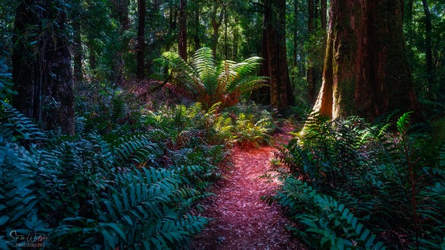
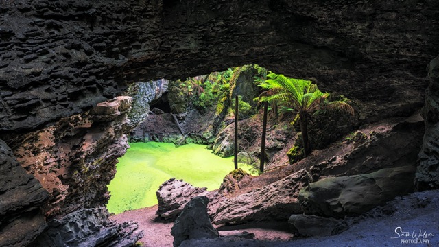
Trowutta Arch
Being a 40-45min drive from Stanley, this is not a hugely popular walk, but oh so worth it. It is a peaceful walk through old growth forest to a remarkable feature that has been created over many years.
The Trowutta Arch Rain Forest Walk leads to a stunning natural geological structure: the Trowutta Arch. Formed by two collapsing cave systems, the arch to one side is filled with water and the other with gigantic Man Ferns.
Needless to say, the walk in and out was in itself so peaceful and enchanting – reasonably flat, you were surrounded by mosses, fungi, ferns, and rainforest canopy the whole way.
I have to admit that I did find it challenging photographing the ‘messy’ scenes of the rainforests. As much as they are beautiful, it can be difficult to isolate an area to create a smaller scene.
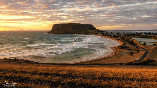
Stanley – ‘The Nut’
Stanley is the most northern point you can stay and explore in Tasmania’s North West. It’s a lovely little town that is apparently known for its well preserved colonial buildings. To be honest I didn’t really get to appreciate those – on this tour it was all about ‘The Nut’.
Research explains that this is the remains of an ancient volcanic plug with a large, mostly flat surface. You can climb the 152m, or catch a chair lift to the top in the right season.
This we didn’t do, although we did photograph it from a few different vantage points, and it’s plain to see why it is what this town is most famous for!
I was intrigued as to why it was called ‘The Nut’ and this is what research uncovered –
“The Nut was first called Circular Head when it was discovered by Bass & Flinders in 1798. The region that surrounds the Nut has since been called Circular Head. It depends who you talk to on the origin of the name the Nut. Some say it is a shortened version of the Aboriginal name for it which was Moo-Nut-Re-Ker. Some also say the name came from when the breakwater was built in 1892. The side of the Nut was packed with explosives to construct the breakwater, once detonated nothing happened and no rocks fell from the side of the Nut. Apparently most of the crowd that gathered to watch the event, agreed that is was a “Hard Nut to Crack”.
~ Information courtesy of Stanley and Tarkine, Tasmania.
Lake Chisholm
This was another lovely walk, similar to the Trowutta Arch walk but once again we were ‘plagued’ (pun intended) with clear bright blue skies, hence the sky not included in this photo.
A beautiful easy walk with lots of distractions along the way.
Edge Of The World
Gardiner Point is where you officially stand at The Edge of World and view the longest uninterrupted span of ocean on Earth. It’s where the Arthur River meets the sea.
So called because it is the starting point of the longest uninterrupted stretch of ocean in the world. The nearest land is Argentina, a mere 20,000km and a long, long, way away.
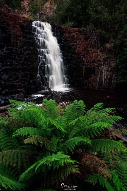
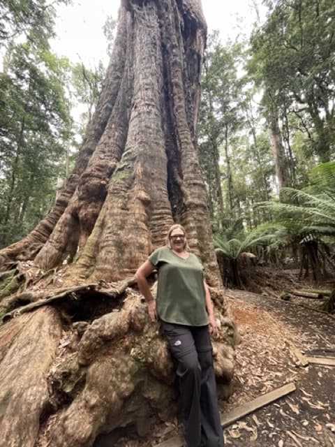
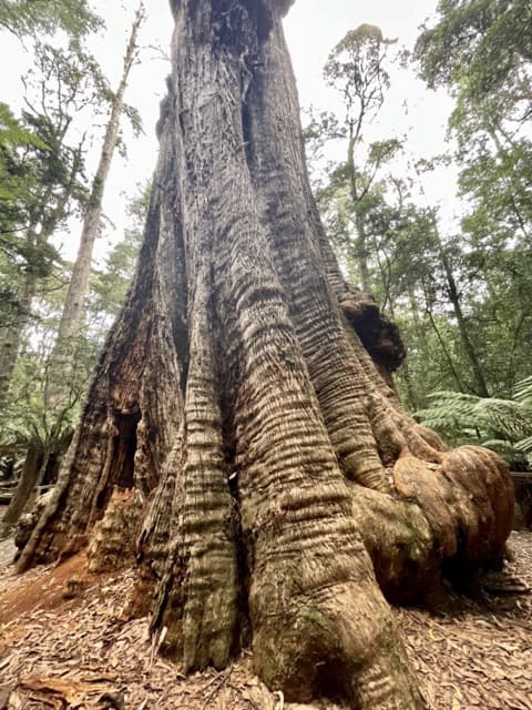
Dip Falls & The Big Tree
Seriously, who names these things?!?
These were an unexpected bonus for me and the falls were well worth the 240 stairs to the bottom to view.
Equally impressive was the Big Tree – I decided to just wander and enjoy it so I only took a couple of photos with my phone.
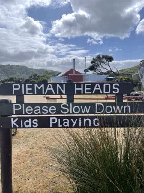
Corinna – Pieman & Savage River
Now this was a huge day! A 3 hour drive from our accommodation followed by a lovely boat cruise down to Pieman Heads. We were able to walk from the boat to the edge of the ocean for lunch.
We drove back up to Marrawah for dinner before heading out to our last sunset not too far away. The drive back was via the Western Explorer – 120km dirt road – we didn’t see any buildings and hardly any other vehicles for most of it, and this was another fabulous reminder of just how remote and special this area is.
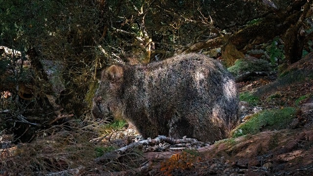
Before heading home a day trip to Cradle Mountain was in order. It really cannot be missed on any tour to Tasmania – specifically the Dove Lake area.
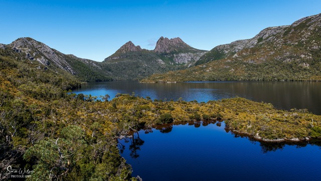
There are numerous walks in the area, but as I did a day tour it was just a quick stop with time to get down to Dove Lake. There’s never enough time but I did manage to spot a wombat!
Conclusion
Although Tasmania can seem small compared to the rest of Australia, you still can’t see it all in a short time. The East Coast is a whole other photography journey that needs it’s own article.
I truly hope you have found this post showing you the photography of North West Tasmania useful.

I know it has brought back some wonderful memories and i can’t wait to head back there again!
What’s your pick of the top North West Tasmania photography locations? I’d love you to let me know in the comments.
That’s it for now – Keep clicking and stay caffeinated
Don’t miss a post – sign up Here if you haven’t already
Note – This post does not contain any sponsored or affiliated links. All suggestions and opinions are mine. Unless otherwise stated, all photos are mine and remain my copyright images – Sam Wilson Photography.
2 Comments