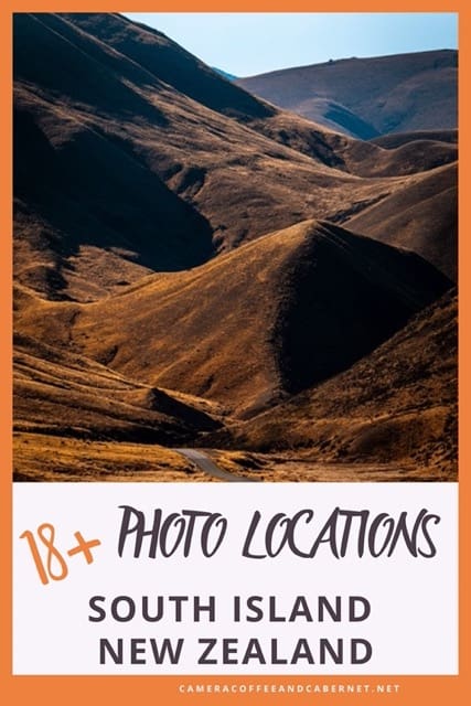
Must-See Photo Locations South Island New Zealand
Welcome to the must-see photo locations South Island, New Zealand
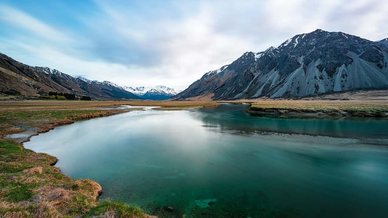
Welcome to the South Island of New Zealand; truly a visual feast for photographers and nature lovers alike.
From the incredible mountains to cascading waterfalls to incredible blue lakes, the South Island of New Zealand offers such a wide variety of landscape photo opportunities. This article will cover all of the locations that I’ve been lucky enough to visit and photograph.
This article provides unique locations for photography, complete with photos for some inspiration, plus relevant Google Map links and photography tips. The goal is to help you capture as many beautiful photos as you can on your next visit.
While some of these are very well known, don’t avoid them. As usual, the most beautiful locations are well known for a reason: they are incredible! Get the tourist shots out of the way, and then capture your own take on what you’re drawn to the most.
The must-see photo locations South Island New Zealand are presented in alphabetical order so there can be no arguing which is my favourite – that would be way too hard!
If you’re planning your next trip, then check out this free Travel Planning Guide you can download:

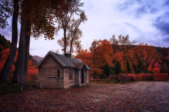
Arrowtown
Established in the 1800’s during the heights of a gold rush, Arrowtown is a quaint little town just a 20 minute drive from Queenstown. Beautiful at all times of the year, it is particularly stunning in Autumn.
Many of the old buildings from this era are still in good condition thanks to careful maintenance: a lovely place to wander the shops and grab the ever-essential coffee.
Google Maps Location: Arrowtown
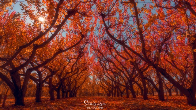
Cromwell
Once a gold mining town, Cromwell is now known for its vineyards and orchards.
For the ultimate in kitsch, check out the big fruit sculpture in the middle of town.
A nice stopover on the drive from Queenstown to Twizel, this area is full of orchards that are definitely worth a photo stop.
Google Maps Location: Cromwell
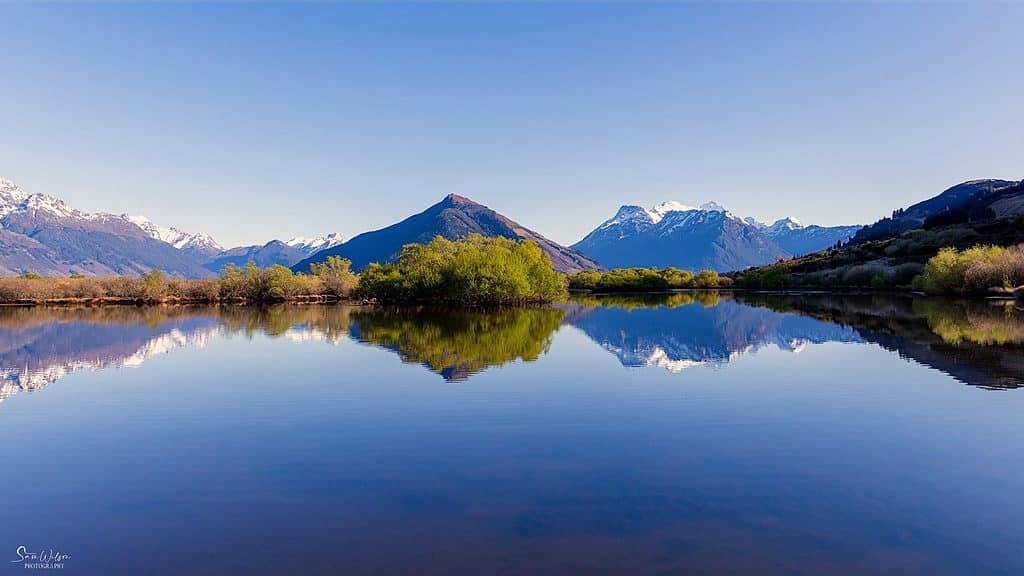
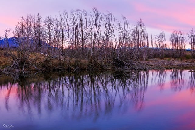
Glenorchy Lagoon
Glenorchy is such a lovely little town and would be a great place to stay for a few nights if you get the chance.
The drive from Queenstown to Glenorchy is such a pretty drive, you need to allow way more than the advised hour for photo stops.
The lagoon has a stunning walkway that I really enjoyed. The walk itself is very easy and the guide says it should only take an hour or so to complete.
Clearly they didn’t have photographers in mind when they wrote this. The official walk starts at Glenorchy Wharf, but you can head just out of town and start wherever you like.
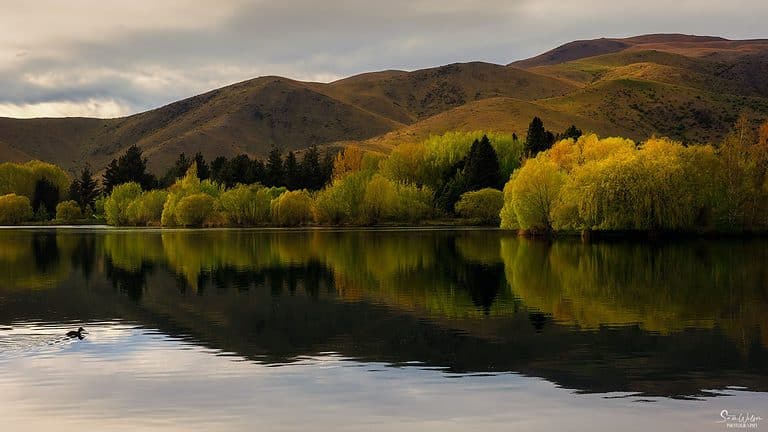
Photo Tip: Best on a calm day if at all possible to get those beautiful reflections, but beautiful at any time. Take your tripod and use a slower shutter speed to help smooth out the water.
Google Maps Location: Glenorchy Walkway Scenic Point
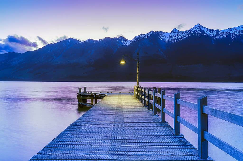
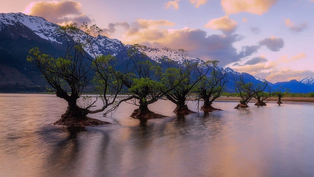
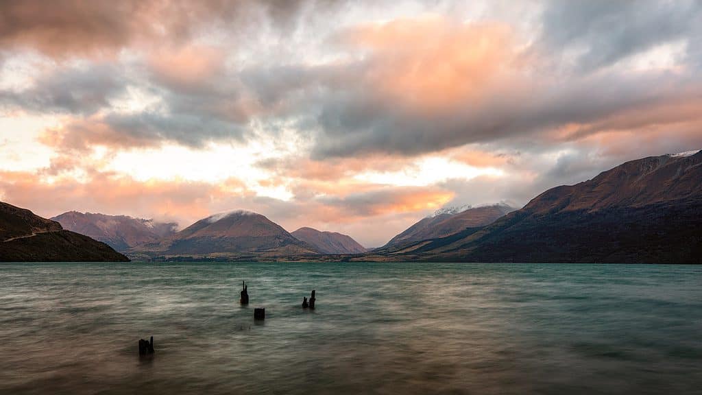
Glenorchy Wharf
This is a really popular instagram photo, and you can see why when you see the photo of the wharf with the light at the end. Aww, what a romantic photo …
That’s so not me, but it is such a lovely spot with so many different composition opportunities. There’s the willow trees (in the photo below), the red shed, and that’s without mentioning Lake Wakatipu with the mountains in the background.
I’ve been there for both sunrise and sunset, and it’s hard to pick which would be the best time. So why not spend a night or two here as mentioned above and do both. There are plenty of other photographic opportunities in the area and some great cafes and restaurants to sample.
There is plenty of parking available, even though it can be very popular:
Google Maps Location: Glenorchy Wharf
Photo Tip: It’s well worth waiting around until the light comes on at the end of the jetty. If you want to get the ‘starburst’ effect, use an aperture of F16 and higher.
Related Post: Creating beautiful sunstars in your photos
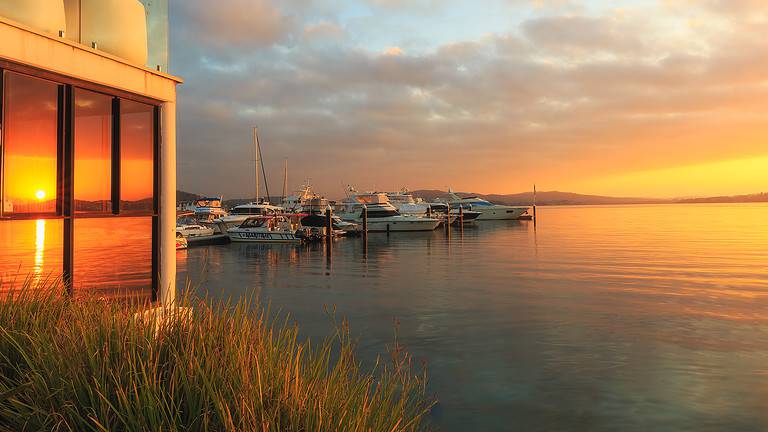
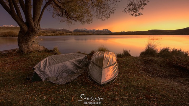
Lake Alexandrina
Located in a campground, this really is a great little hidden gem. I’ve seen very few photos from here apart from those I was with at the time of visiting.
It is a beautiful lake with little jetties dotted all around. While I’m not particularly keen on jetties, I was very taken with the boats lining the shore.
Google Maps Location: Lake Alexandrina
Lake Dunstan
Lake Dunstan is a really popular location for cycling, but also beautiful for a photography stop when driving from Queenstown to Cromwell and beyond.
This man-made lake was created as the result of the construction of Clyde dam and was finished in 1993.
There are many places to pull over, so as usual when travelling around the South Island of New Zealand, allow more time than you think you need.
Google Maps Location: Lake Dunstan
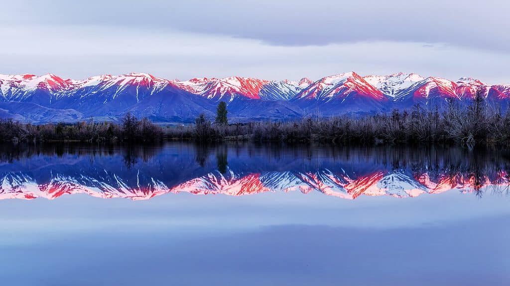
Lake Ohau
Around a 30 minute drive from Twizel, Lake Ohau really can be considered a hidden gem.
Just as beautiful (if not more so) than the popular Lake Tekapo and Lake Pukaki, very few visitors venture here. And that’s a good thing. Both times I’ve visited here, there have been NO other people around!
Google Maps Location: Lake Ohau
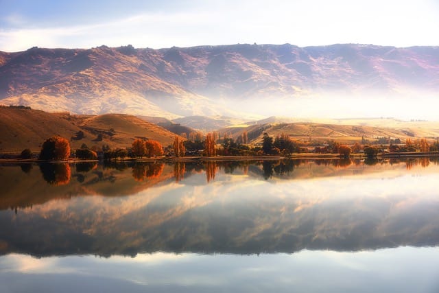
Lake Poaka
Located just outside of Twizel, this hidden gem for photography is also a popular camping spot.
Twizel is a lovely little town that is surrounded by lakes and a great base for exploring a number of locations mentioned in this article including Lake Pukaki, Lake Ruataniwha and Lake Poaka.
These lakes all make from incredible reflection photos, and during autumn the trees become a riot of yellows and gold.
Google Maps Location: Lake Poaka
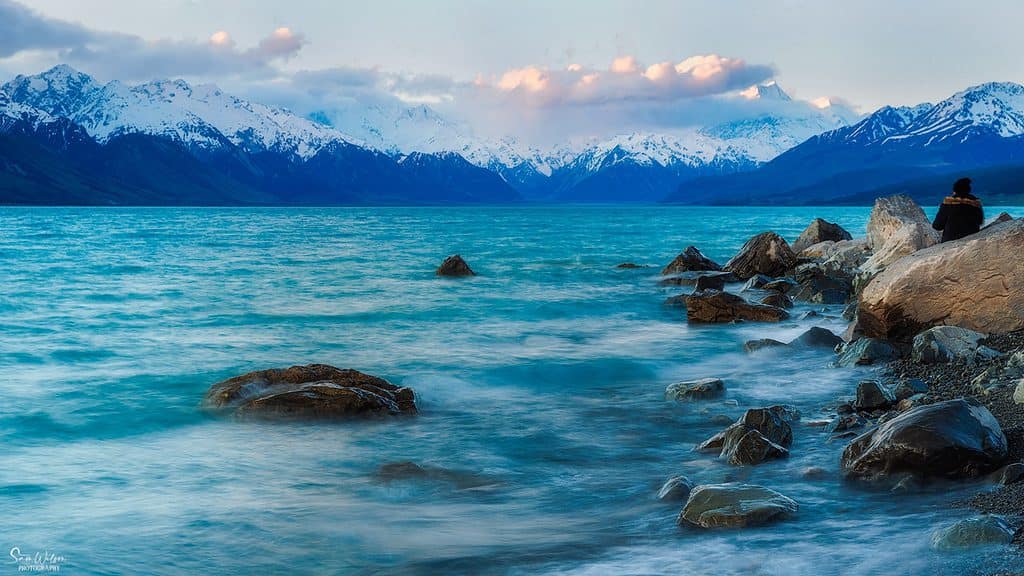
Lake Pukaki
Lake Pukaki is such a beautiful lake. It’s surrounded by beautiful snow-capped mountains pretty much year round, and the colour of the water is such a beautiful blue.
It is a must place to photograph as you can get great views of Mount Cook in the distance. This is of course on the days that Mount Cook (Aoraki) isn’t hiding behind clouds.
The location link below is just one of the many places you can stop to photograph. Be sure to allow plenty of time and explore other dirt roads around the lake. There are some incredible compositions to be had if you take the time to explore.
Google Maps Location: Lake Pukaki
Lake Ruataniwha
Located just out of Twizel, Lake Ruataniwha is an artificial lake that was formed as a result of the Upper Waitaki Hydroelectric project.
Google Maps Location: Lake Ruataniwha
And so comes the end of the lakes in this article.
What makes the water so blue I hear you ask?
The water can appear blue due to the fact that the water is clean and clear, and is surrounded by greenery.
Also, the lakes are fed by glaciers, which gives the water a cloudy or milky appearance. This is due to glacial flour(extremely fine rock particles) infusing the water, causing it to look so blue or turquoise.
The colour of the water is also affected by factors such as water depth, sunlight, time of day, season and different weather conditions.
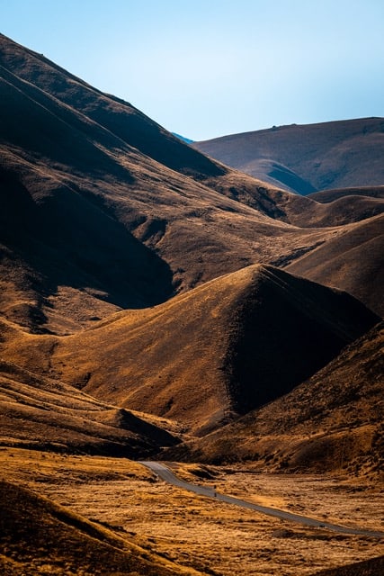
Lindis Pass
Lindis Pass links the Mackenzie Basin with Central Otago, and there is an amazing viewpoint that I totally recommend.
There is a signposted car parking with a small lookout. It’s easy to miss so make sure you’re keeping an eye out on your map.
Don’t worry too much about missing it, you won’t be speeding along this windy and mountainous road – take it easy and enjoy the scenery.
Apparently you can see snow on the tops of the mountains most times throughout the year. This was certainly the case when I visited both in autumn and spring.
Google Maps Location: Lindis Pass Viewpoint
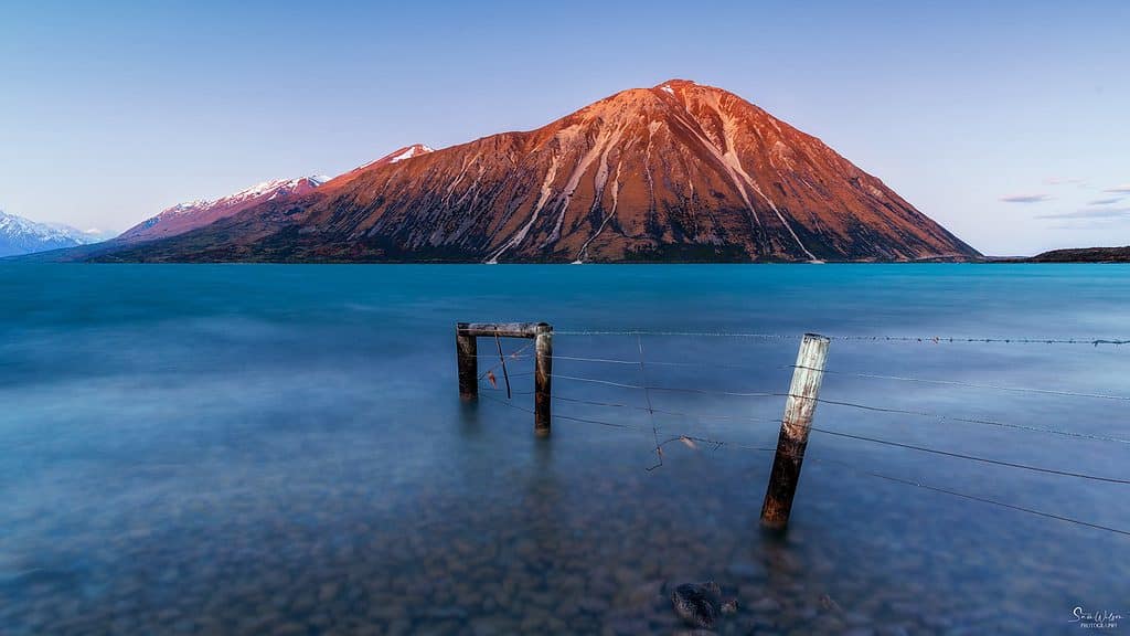
Meiklejohns Bay
You’ll find this little hidden gem just on the side of the road on the drive between Queenstown and Glenorchy.
There are numerous places to pull over safely so keep your eye out and look for the sticks in the water.
Google Maps Location: Meiklejohns Bay
Queenstown
A great place to base yourself in for a few days, Queenstown is a very busy touristy town, but don’t let that put you off. It has fabulous accommodation, restaurants, and there is just so much to see and do.
Not only is Queenstown known as the adventure hub of New Zealand, but it also boasts some of the most breathtaking landscapes imaginable. Located on the shores of Lake Wakatipu and with the Remarkables in the background, there are endless opportunities for capturing stunning photographs.
You can take a short walk from the town to the lake and enjoy the view. You can also take a short drive to visit smaller lakes like Lake Kirkpatrick, Lake Hayes and Moke Lake for different experiences. There are many more activities to do such as taking a gondola ride for breathtaking views.
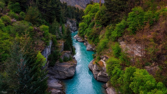
Shotover Gorge
If you’re feeling adventurous, check out the shotover jet from Queenstown for your adrenaline fix, ride through the narrow Shotover Canyons at ridiculous speeds. I haven’t been this brave yet, but I’m determined to attempt it on my next visit.
Now if you want to take a photo over the beautiful Shotover Gorge, then Edith Cavell Bridge is where you need to head.
You can park just over the bridge on the left-hand side heading out of Queenstown and head back to the bridge.
Google Maps Location: Shotover Gorge
Photo Tip: Please take extreme care as the path on either side of the road is only narrow and it is a busy road!
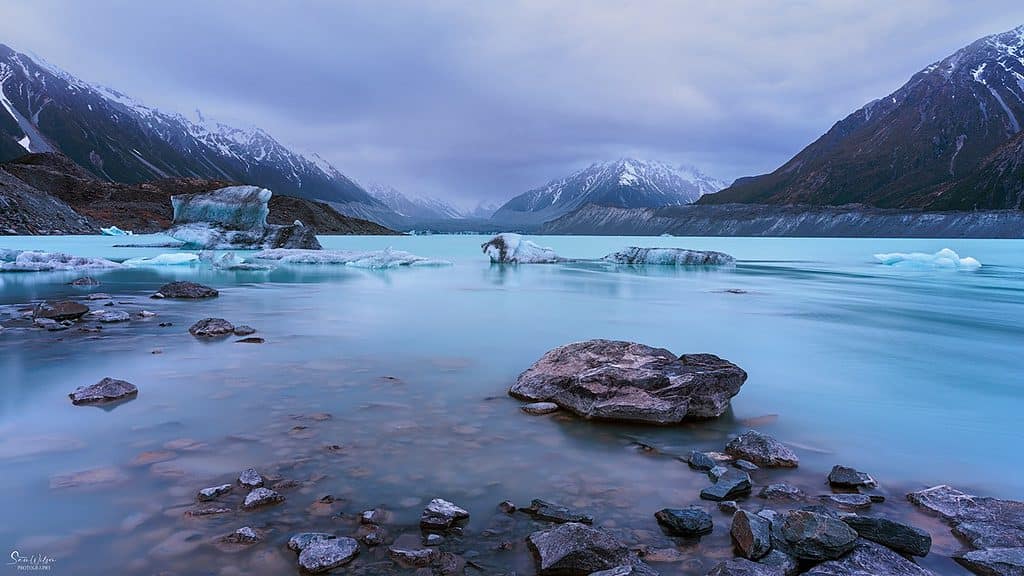
Tasman Lake
Tasman Glacier stretches for 27 km and is up to 600 km in depth. Research indicates that this glacier is currently in a period of accelerated retreat and the terminus is not only melting, but also calving. This has resulted in icebergs of every shape and size periodically tearing away from the glacier.
The water is an incredible blue and icebergs break off the glacier and float down into the river. This means that you never get the same view twice, so you are guaranteed unique photos.
It truly is one of the most amazing sights I have ever seen. Don’t tell anyone, if I had to pick a favourite location in New Zealand, this would probably be it.
There are many ways to access this area including helicopters if you’re keen. The two times I’ve visited, I’ve walked in from the carpark. The walk is well maintained, easy and takes around thirty minutes each way.
Google Maps Location: Tasman Glacier Car Park
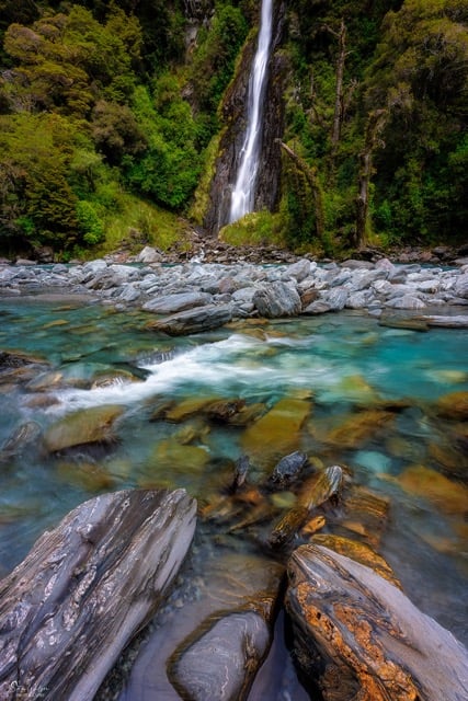
Thunder Creek Falls
Located about an hour and a half from Wanaka along the Haast Highway, Thunder Creek Falls are a must visit for photographers.
There’s plenty of space for parking, but be aware there’s no amenities here. The closest amenities are a few minutes away at Pleasant Flats just a few minutes away.
It’s less than a five minute walk from the car to the viewing platform and it’s an easy walk – bonus!
It’s only a couple of flights of stairs down to the creek bed so you can easily wander around and play with different compositions. Just make sure you have decent walking shoes.
Google Maps Location: Thunder Creek Falls
Photo tip: Try and arrive earlier in the day to avoid harsh sunshine and other people! Don’t forget your tripod, and take the widest lens you can: these waterfalls are tall (28 metres to be precise)!
Wairepo Arm
Located just outside of Twizel, Wairepo Arm is part of the bigger Lake Ruataniwha mentioned above, and well worth a visit.
If you’re still craving more breathtaking blue lakes (let’s be real, who doesn’t?), then a stroll around Wairepo Arm is a must.
Not only is it a lovely area for a stroll, but it’s also a well-known spot for bird watching. So, be sure to bring your big lens along.
Google Maps Location: Wairepo Arm

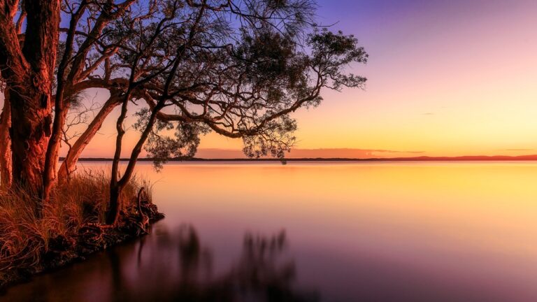
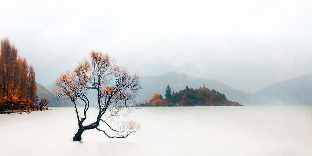
Wanaka Tree
That Wanaka Tree – this small willow tree must be one of the most photographed trees in the world.
It’s a great location for both sunrise and sunset, but if I had to pick, it would be sunrise. This is because of the light that hits the mountains in the background as the sun rises.
Because it is so incredibly popular with tourists, it can be hard to find a spot to even stand. I’ve seen photos where there have been over 100 people there, and it’s only a small area.
This is another bonus of photographing here at sunrise – there are way less people!
I’ve been there in both autumn and spring. Autumn would be my favourite due to the gorgeous golden coloured leaves.
Google Maps Location: #ThatWanakaTree
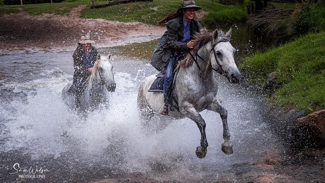
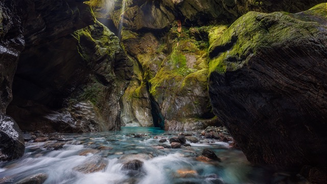
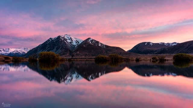
Bonus Locations From Going On A Photography Tour
I went on a photo tour and visited some special places that aren’t quite so easy to find online. Out of respect for the guide who took us to these locations, I prefer not to share the location details.
But here are some photos from those spots, and hopefully they will encourage you to do a photo tour or workshop. They really are worth it and here is why I recommend them. Reasons To Do A Photography Tour.
Still On The Bucket List
I would be remiss not to mention some of the locations that I believe are a must to photograph, I just haven’t made it there, yet …
- Moeraki Boulders
- Milford Sound
- Lake Tekapo and the Church Of The Good Shepherd
- Wharariki Beach
- To name just a few …
I’m sure there are many, many more. If you have any that I should also add to this list, I’d love you to let me know in the comments below.
And, if you’re looking at planning your next trip, then check out this free download:

That’s it for now – Keep clicking and stay caffeinated
Like this post? PIN it so you can save it for later.
Don’t miss a post – sign up Here if you haven’t already
Note – Unless otherwise stated, all photos are mine and remain my copyright images – Sam Wilson Photography.